Assessing the value of flow-balanced spatial interaction models for the study of long-term settlement evolution: the case study of the Pontine region (Central Italy) from the Archaic to mid Imperial period (c. 600 B.C. – A.D. 250)
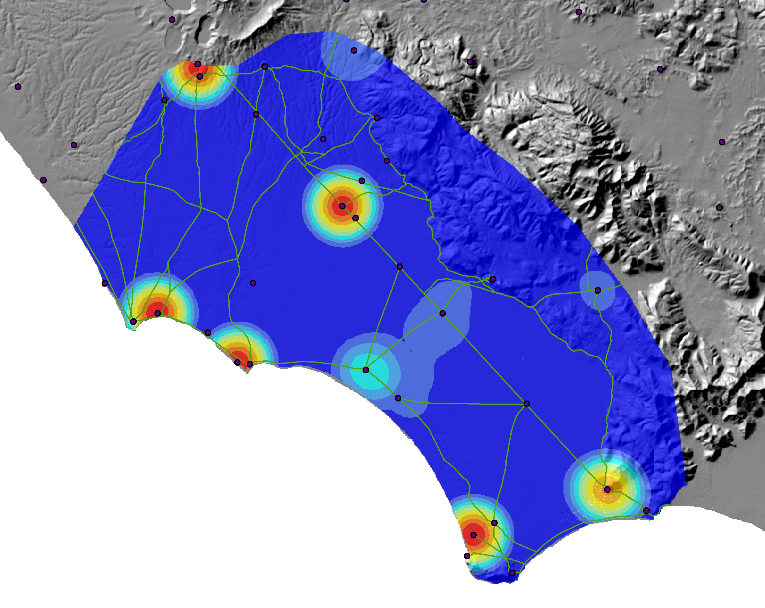
Spatial interaction models that draw from entropy-maximising methods have been increasingly used in archaeology in recent years to explore long term settlement evolution, and in particular, the emergence of regional central places. The application of such models to archaeological datasets has so far suggested that they can capture some essential properties of evolving settlement structure, despite the challenges presented by incomplete and fragmented archaeological datasets. Still, the validation of these models has so far mainly relied on sparse evidence on the sizes of often poorly preserved settlements and limited proxy data (artefact distributions, textual sources) suggesting central place functions, while it is less clear to what degree such models could be a good fit for better contextualised regional datasets. In this project we combine a flow-balanced spatial interaction model (sometimes called Boltzmann-Lotka-Volterra model) with a minimal regression based predictive modelling to examine the settlement evolution in the Pontine region between the Archaic and mid Imperial period (c. 600 B.C. – A.D. 250). In the past such a modelling approach has been used to address uncertainty introduced by “missing” settlements in study areas that have not been systematically surveyed, but our aim here is to explore whether the models in question will remain relevant and useful when employed to an unusually well contextualised and rich (yet still patchy) archaeological record that offers a greater range of indicators for central place functions. The results of our modelling approach are here contrasted and evaluated with reference to a variety of evidence on demographic growth and decline, changing infrastructural networks, and production and consumption patterns in the Pontine Region (Central Italy). In particular, we assess the suitability of the spatial interaction model to offer useful insights on the emergence of central places in three subsequent periods (Archaic / 600-350 BC, Republican/350-50BC and Imperial/50BC - AD 250). It appears that the suitability of the model indeed varies between these three periods, which seems to result from their very different patterns of urbanisation, rural economies and socio-political contexts. The project also offers some insights into the links between model assumptions, data uncertainty, changing socio-economic structure and various notions of economic, administrative and religious centrality.
Contact:
- Prof. Dr- Eleftheria Paliou
- Dr. Tymon de Haas
Funding:
-
in the framework of the Research Training Group 1878, Archaeology of Pre-modern economies